
Without question, this was one of the most memorable days of the entire trip.
We’d already fallen for Tafraout in the way you sometimes fall for a place unexpectedly – the quiet, the scale of the granite landscape, the complete absence of anything resembling a tourist circuit. But this hike took everything we loved about the area and distilled it into a single long day out in the mountains. We came back dusty, footsore, and holding hands a little tighter than when we’d set off.
If you’re looking for one of the best hikes in Tafraout, this self-guided Anti-Atlas loop combines granite mountains, hidden pools, traditional Amazigh shepherd paths and spectacular views, all within easy reach of the town centre.
It wasn’t yet 6am, but the daylight was already there. We walked out through the streets of Tafraout in near-total silence, broken only by a dog barking somewhere in the distance and the first cockerels of the morning. The air was still cool, and it was already clear we were in for another cloudless day.
Why You Need an Early Start
In the summer months, temperatures in the Anti-Atlas valley can climb to 38°C or higher by mid-morning, which makes timing everything. We were out of the door at Maison de Vacances Tafraout before six, aiming to be back in the early afternoon, well before the worst of the heat set in.
This isn’t advice to take lightly. Hiking at midday on rocky, unshaded terrain with no water source is genuinely uncomfortable, and potentially dangerous. Leave early, carry more water than you think you’ll need, and plan to be back somewhere shaded well before 2pm. The best time of year for hiking around Tafraout is generally September to May, when temperatures are far more forgiving throughout the day. If you’re visiting in early summer, as we were, an alpine start is non-negotiable.

Hiking Route from Tafraout to the Hidden Valley
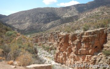
We set off directly from our accommodation, heading north-east out of town before turning south once we reached the edge of the mountain range. The loop carried us through a series of valleys and across dramatically rocky terrain, eventually rejoining the main road near the village of Agard Oudad — best known as the home of Napoleon’s Hat.
The total distance was around 8 kilometres, but allow at least four to five hours to enjoy it properly. The terrain is uneven and rocky throughout, the heat demands frequent rest stops, and this is the kind of landscape you’ll want to slow down in rather than push through. We stretched it out further still, stopping for photographs and two separate picnics along the way – there was never any temptation to rush.
The trails here follow old shepherd paths, and while some stretches cross open, pathless terrain requiring careful route-finding, the overall logic is simple: keep the mountain range on one side, check your GPS if unsure, and you’ll rejoin the road without difficulty. There’s no marked trail and virtually no signage, so a downloaded offline map is essential.
For anyone wanting a rough waypoint guide, our route began at Supermarché Salam on Route Imiyane in Tafraout (29.7238, -8.9625), climbed through the hills north-east of town, then turned south through the valleys before rejoining the R107 near Agard Oudad and following it back to the guesthouse.

The Hidden Valley and Seasonal Pools
This was the surprise of the day.
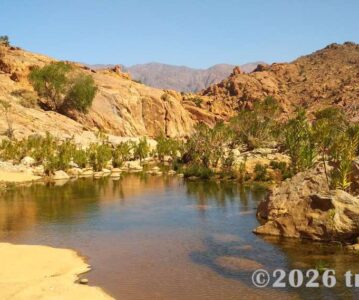
In the dry riverbeds threading through the valley floor – places where water often disappears completely in summer – we found small, still pools held in pockets of shade and rock. Frogs called from the banks, and the landscape felt suddenly alive in a way we hadn’t expected.
On our return in the softer evening light, fireflies drifted above the water. We sat for a long time without speaking, simply watching a scene that had nothing to do with tourism and everything to do with place.
According to Wikivoyage, similar routes in this area can occasionally reward walkers with sightings of Cuvier’s gazelle, a shy species with a total wild population of only around 2,000, most of them in Morocco. We spotted a few in the distance, well away from our path. Even the possibility of them added a different quality of attention to the walk.
Breakfast on the Mountain
One practical detail made a huge difference: we carried breakfast.
After climbing into the foothills and watching the sun rise over the granite ridges, we stopped just after six and ate bread, cheese and fruit perched on a boulder with nothing around us but rock and sky. A small group of goats grazed nearby, completely unbothered by our presence.
Later, before the heat fully set in, we stopped again for a second, more substantial picnic. Carrying food adds weight, but it removes pressure – no need to search for anything in the hills (there isn’t anything), and it gives you permission to sit and stay in places you’d otherwise just pass through.

What Hiking in the Anti-Atlas Feels Like
This is worth saying clearly, because it feels different from hiking in many other parts of Morocco.
The Anti-Atlas has a quiet, rural character that sets it apart from the more established trekking regions. Much of its potential remains undeveloped, and Tafraout is still firmly off the main tourist circuit.
On this walk we passed shepherds with their flocks, women in bright jellabas gathering firewood, the occasional mule and cart. The trails follow old Amazigh (Berber) routes, and there’s a sense of moving through lived landscape rather than a designed hiking route. We met only a couple of other people all day.
For couples who prefer hiking that feels exploratory rather than managed – where you navigate rather than follow signage – this is exactly that kind of experience.
Napoleon’s Hat
The village of Agard Oudad sits around two kilometres south of Tafraout, directly beneath the iconic Napoleon’s Hat – a granite tor that appears on almost every postcard of the region.
We only viewed it from the main road, without detouring into the village, but that was enough. By then the afternoon heat was building and our legs were tired from the climb, so we continued back rather than lingering.
From the right angle, the resemblance to a bicorne hat perched on the hillside is genuinely striking – an unexpected landmark at the end of a long walk.
If you’re combining this hike with the Painted Rocks, both sit within easy reach of each other and can be linked into a longer exploration of the valley.
Practical Tips for Hiking in Tafraout
Navigation
There are no marked trails or signposts. Download offline maps (Google Maps or Maps.me) before leaving and rely on GPS waypoints if needed.
Water
Carry at least two litres per person in cooler months, more in summer. There is nowhere to refill.
Food
Bring a picnic. You’ll want it, and you’ll find plenty of natural places to stop.
Footwear
Sturdy hiking shoes or boots are essential. The terrain is rocky and uneven throughout.
Timing
Start before 5:30–6:00am in summer. Aim to return before early afternoon.
Guided options
Local guides can be arranged in Tafraout if you prefer support or a more structured route.
GPS Waypoints for Our Route (approximate)
- Start: Supermarché Salam, Route Imiyane – 29.7238, -8.9625
- 29.7130, -8.9582
- 29.6929, -8.9513
- 29.6780, -8.9510
- R107 near Agard Oudad (Napoleon’s Hat)
- Return along R107 to Maison de Vacances Tafraout
No responsibility can be taken for route conditions, which can change. Always carry an offline map and let someone know your plans before setting off.
For the full picture of Tafraout – where to stay, what to eat, the Painted Rocks, and cycling in the Ameln Valley – see our complete Tafraout travel guide. And for the wider route through southern Morocco, our 12-day Morocco road trip itinerary from Agadir to the Anti-Atlas ties everything together.
Final Thoughts
Looking back, this wasn’t just our favourite hike in Tafraout – it was one of the defining experiences of the entire Morocco road trip. There’s something quietly powerful about setting out on foot from a sleeping mountain town, following ancient Amazigh paths through an almost empty landscape, and returning with dust on your boots and a clearer sense of place. If you have time in Tafraout, don’t miss this walk. It reveals a side of the Anti-Atlas that most visitors never see, and it’s exactly the kind of day that stays with you long after the journey ends.
Travel42 UK is a couples travel journal dedicated to immersive road trips, slow travel, and destination storytelling.
Explore More of Morocco:
–



The long way round, as a couple
About the Author
The author, ainarsbl, is a Level 7 Google Local Guide, Master Reviewer and expert travel reviewer focused on scenic landscapes, UNESCO sites and meaningful couples travel experiences.