Part of our 12-Day Morocco Road Trip from Agadir to Tafraout & the Anti-Atlas series.
Most people who know Morocco will have heard of Agadir – the modern, beach-lined Atlantic city that serves as the country’s main resort destination. What far fewer people realise is that agadir is not just a city name. In the Amazigh (Berber) language, the word means “wall”, “enclosure”, or “fortified compound”, and there are dozens of structures bearing this name scattered across the mountains and valleys of southern Morocco – most of them centuries old and almost entirely unvisited.
We stumbled across this world almost by accident. A recommendation from someone we met in Morocco sent us in search of Agadir Inoumar – a name that meant nothing to us at the time. We had approximate coordinates and rough directions, and that was enough. What we found was extraordinary.
What Are the Berber Igoudar?
Before arriving at Agadir Inoumar itself, it is worth understanding what these structures actually are, because they are far more interesting than the word “granary” might suggest.
The Amazigh people – Morocco’s indigenous Berber population, whose history in North Africa stretches back at least 4,000 years – developed a remarkable system of communal fortified granaries known collectively as igoudar (the plural of agadir). These were not simply food stores. They functioned more like community banks: each family within a tribe had its own locked chamber inside, where they secured not only grain, olive oil, and honey, but also jewellery, important legal documents, and other valuables.
Access was controlled by an elected guardian known as the amin, and the chambers were secured with distinctive hand-carved wooden keys – some of the finest examples of Amazigh craftsmanship you will find anywhere in Morocco.
The oldest igoudar in Morocco date back to around the 10th century, although most of those still standing in the Anti-Atlas and Souss Valley were built between the 13th and 18th centuries. They were typically positioned on elevated or rocky ground, both to provide a defensive advantage and to keep stored goods cool and dry in the intense heat. In an era before banks, before reliable harvests, and before security as we understand it today, these structures formed the backbone of Amazigh community life.
Many have since fallen into ruin. Others have been carefully restored. Agadir Inoumar is among the most impressive examples of the latter.
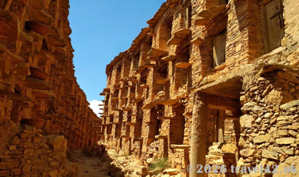
Standing in front of the complex for the first time – before the guide had even approached us – we were already taken aback by the sheer scale of what we were looking at. The multi-storey structure rises in tiers of stone, and even now it is difficult to fully imagine how people accessed the upper chambers, particularly when carrying heavy goods. The architecture raised as many questions as the guide answered.

About Agadir Inoumar
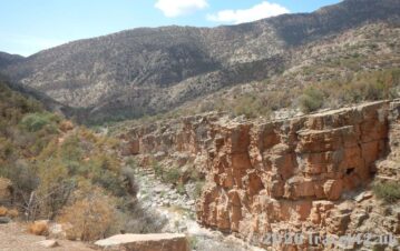
Agadir Inoumar is widely considered one of the largest collective granaries in the western Anti-Atlas. Built more than 300 years ago during the Alaouite dynasty – specifically during the reign of Sultan Moulay Ismaïl – it sits dramatically on a hillside overlooking the Oued Ourga valley, roughly between Agadir and Taroudant in the Chtouka Aït Baha Province.
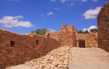
The scale of the place is genuinely surprising. Around 600 individual storage cells are arranged across three aisles and three floors, each tier accessible via protruding stones built into the outer walls – a kind of permanent ladder incorporated directly into the structure by Amazigh masons. Four corner towers, three water towers, and two entrances complete the fortified layout.
It looks far less like a grain store and far more like a small citadel – which, in many ways, is exactly what it was.
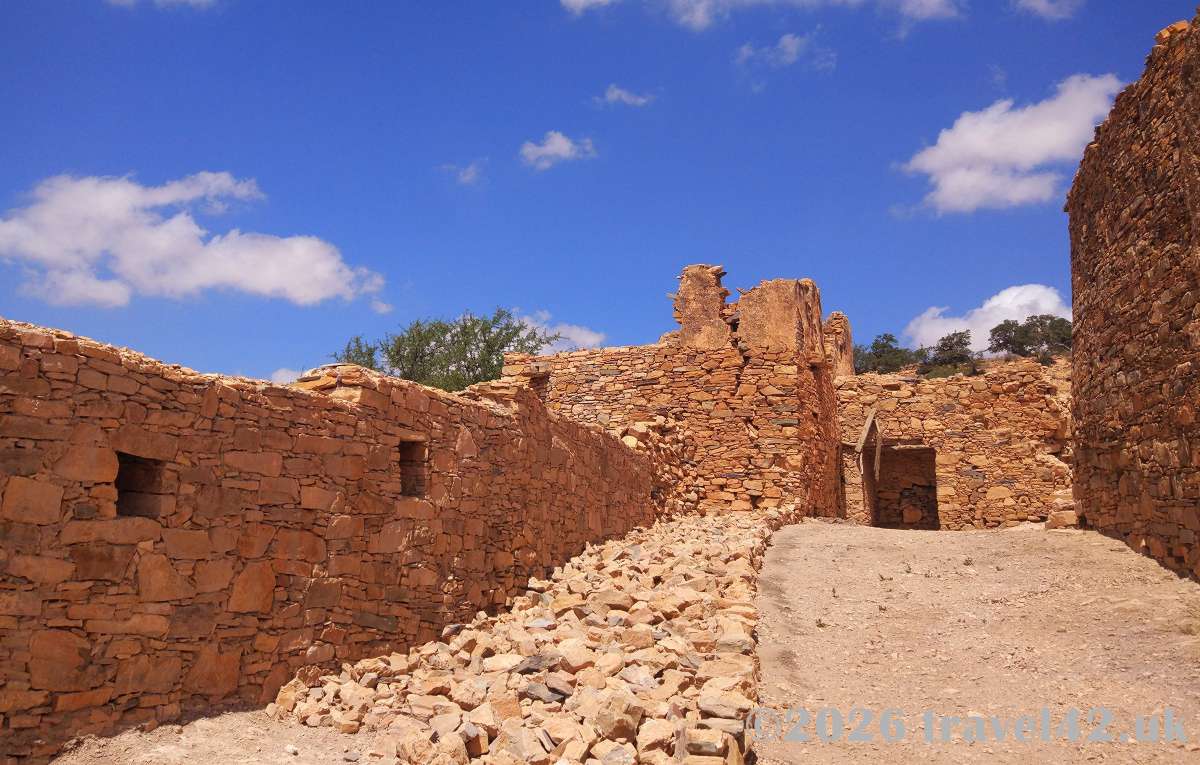
The granary is not visible from the road, nor from the small cluster of houses nearby. You need to walk a short distance before it reveals itself, perched on the edge of the hillside with the valley dropping away beneath. That first view, once you round the final bend in the path, is worth the journey on its own.
Getting There
Navigation to Agadir Inoumar deserves some thought in advance – not because the drive is particularly difficult, but because the usual tools are not entirely reliable here. Google Maps coverage in this part of Morocco has historically been patchy, and signage remains sparse in places.
The granary is located near Afaïane in the Chtouka Aït Baha region. The precise GPS coordinates are: 30.163274, -9.108826
Arriving from Agadir
Take the R105 via Biougra and Imi Mqourn. This is the safest and most straightforward route, as it avoids crossing the Oued Ourga riverbed entirely. Road conditions are generally very good throughout.
Arriving from Taroudant
The route is equally manageable, with one exception: a riverbed crossing near the Ciments du Maroc plant (coordinates: 30.196085, -9.176542), where the original bridge was damaged by flooding several years ago. Under normal dry conditions, the crossing is straightforward. After heavy rain, however, it may become impassable. If there is any doubt, approach via Agadir and the R105 instead.
Once past Chtouka, continue east. The road is now properly mapped and surfaced, making the journey much easier than when we visited. The scenery is attractive enough to justify a few stops along the way – quiet villages, sweeping valley views, and the occasional roadside café.
Visiting the Site
Park near the village of Talkerdoust. The informal parking area is located at: 30.166697, -9.107983
There is no official signage, but there is plenty of space to leave a car safely.
From here, the granary remains hidden from view. A walk of roughly 600 metres downhill to the south-west brings you to the site itself.
The path is uneven in places, so sensible footwear is recommended. This is not a landscaped tourist attraction. Allow approximately 15 minutes each way.
At the site, a local guide will almost certainly come to meet you and offer a tour. He speaks Berber and French rather than English, but even a modest understanding of French is enough to follow the essentials. Where language falls short, the architecture speaks for itself.
He will guide you through the narrow internal passageways, explain how the storage chambers were allocated, and bring the social history of the granary to life.
Our own French was limited, to put it kindly, but between the two of us we managed to follow the broad outline of the story and even ask a few questions. By the end, there was a certain shared satisfaction in having bridged the language gap – on both sides, we suspect.
After the visit, a contribution of around 100 MAD is customary and genuinely appreciated. This covers both the guide’s time and ongoing restoration efforts.
One detail that caught us entirely by surprise: there are clean, well-maintained toilets on site. In this context, that counts as a significant luxury.
Further information in English is available at HOME | agadirinoumar.
Practical Summary
| Detail | Information |
| GPS coordinates | 30.163274, -9.108826 |
| Parking | 30.166697, -9.107983 (informal parking near Talkerdoust) |
| Walk from parking | Approx. 600 metres / 15 minutes downhill |
| Best approach from Agadir | R105 via Biougra and Imi Mqourn |
| Best approach from Taroudant | Via Chtouka (avoid riverbed crossing after heavy rain) |
| Guide & entry | Approx. 100 MAD donation |
| Languages spoken | Berber and French |
| Further information | https://cooperativetourist.wixsite.com/agadirinoumar |
Final Thoughts
Places like Agadir Inoumar sit entirely outside the standard Morocco itinerary. There are no tour buses, no souvenir stalls, and no queues.
We had not planned the visit at all, largely because we had no idea such places existed. It was only afterwards, when reading more about the subject, that we realised how many of these remarkable fortified granaries still survive across the Anti-Atlas – and how little attention most of them receive.

There is something genuinely moving about walking through a building that communities depended upon for centuries — not only for food storage, but for safeguarding documents, wealth, and collective security. In a landscape that feels largely untouched by modern tourism, the weight of that history is surprisingly easy to feel.
If you are travelling through the Anti-Atlas as part of a wider southern Morocco itinerary – particularly the route between Agadir and Tafraout that forms the backbone of our 12-Day Morocco Road Trip from Agadir to Tafraout & the Anti-Atlas – Agadir Inoumar fits naturally into the journey. From Taroudant, it makes an excellent half-day excursion. From Agadir, it works well as a rewarding day trip before heading deeper into the mountains.
It is not Morocco’s grandest attraction. It does not have the fame of Aït Benhaddou, the spectacle of the Sahara, or the energy of Marrakech.
But it is one of those places that stays with you.
A quiet, unscripted encounter with the past, made possible only because someone happened to mention it. Not every great travel experience comes from a guidebook – and Agadir Inoumar is a perfect example of why it pays to venture beyond the obvious.
Travel for Two is a couples travel journal dedicated to immersive road trips, slow travel, and destination storytelling.
Explore More of Morocco:
–


The long way round, as a couple
About the Author
The author, ainarsbl, is a Level 7 Google Local Guide, Master Reviewer and expert travel reviewer focused on scenic landscapes, UNESCO sites and meaningful couples travel experiences.